
Hart’s Cove Trail, Oregon Coast: Complete Hiking Guide Near Lincoln City (2026)
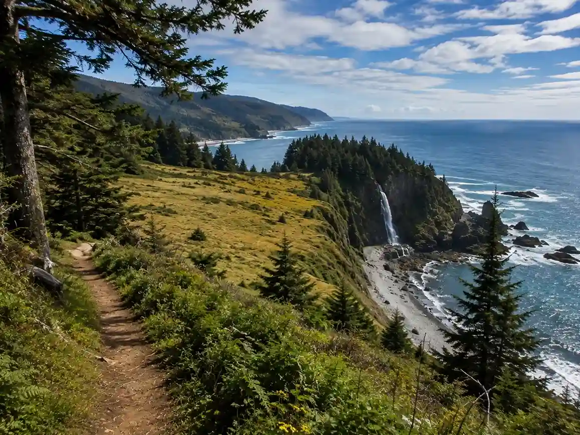
Ask any seasoned hiker along the Oregon Coast where to find a genuinely breathtaking hike, and Hart’s Cove Trail near Lincoln City comes up fast. I still remember the moment the trees broke open and that unforgettable view hit me — the Pacific Ocean stretching out below a wide-open meadow, with Chitwood Falls tumbling toward a secluded cove. This isn’t just another coastal walk; it sits inside the Cascade Head Biosphere Reserve, a UNESCO-recognized stretch of old growth forest and old-growth rainforest that still feels genuinely wild.
Rated Moderate by most trail apps, this out-and-back trail runs around 5.3-mile (8.6 km), taking roughly 02:46h to cover 8.59km with about 370m elevation gain — though the figures shift depending on which trailhead you start from. Reviewers give it a modest 3.3/5 from 25 ratings, with 91 hikers logging the route so far. The UNESCO designation goes back to 1976 and was reauthorized in 2017, protecting the temperate rainforest environment and the habitat it provides for endangered species like the spotted owl, marbled murrelet, Oregon silverspot butterfly, and Coho salmon, alongside elk, black bear, bald eagles, and barking sea lions.
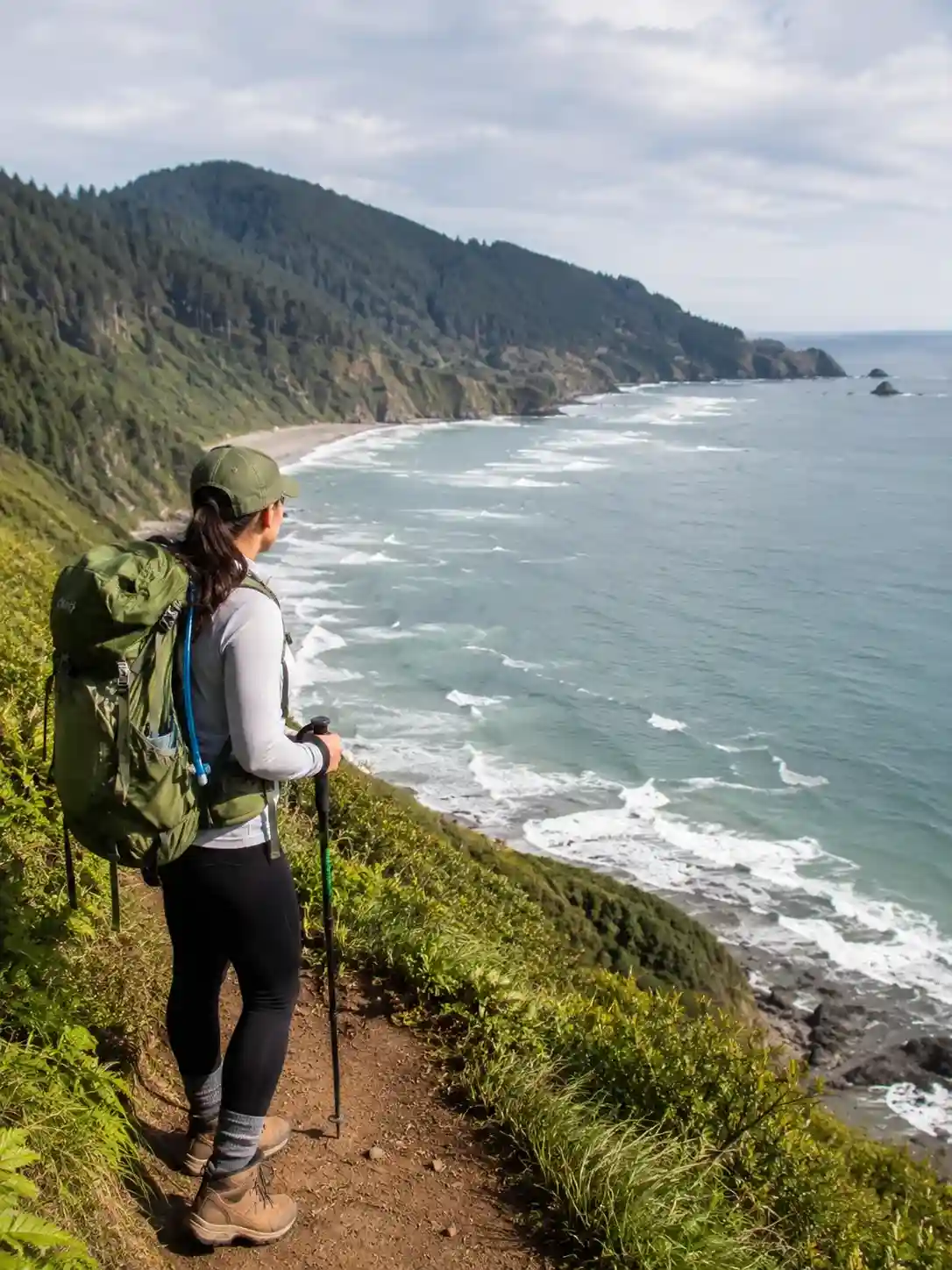
What makes this moderate hike so memorable is the dramatic shift in scenery: you start descending through coastal meadows and sensitive habitats, work through switchbacks and creek crossings, then find yourself climbing switchbacks again on the way out, past massive trees and native grass prairies. Along the connected Cascade Head Trail, Sitka spruce forests give way to sweeping coastal views — the Salmon River estuary, a long U-shaped spit, and coastline rolling south toward Boiler Bay. Every protected area along this headland rewards you with breathtaking views and fields of wildflowers that seem to change color with the season.
Trail Stats / Difficulty / Distance
Numbers on this trail depend entirely on which route you pick, and honestly, that’s tripped up more than one hiker I know. Per AllTrails, the Harts Cove via Lower and Upper Cascade Head and Harts Cove Trail is logged as a hard hike — 14 mi, 2,788 ft of gain, roughly 7–8 hr out and back, rated 4.5 stars from 152 reviews. The shorter Hart’s Cove Trailhead to Hart’s Cove approach is friendlier: 7.8 mi with 1,446 ft of elevation gain, still a moderate hike, an out-and-back trail through and through.
Then there’s Komoot’s version, listed simply as Moderate, clocking 02:46h over 8.59km with 370m elevation gain. Oregon.com pegs the classic route at a 5.4-mile hike with 900 feet elevation loss rather than gain, since you’re dropping toward the ocean. Some hikers swear the real number is closer to 15-16 miles, insisting the incorrect distance listed online doesn’t match their GPS tracks — I’ve heard the same complaint more than once on the trail myself.
Toward Cascade Head itself, expect around 4.5 miles and 1,200 feet elevation gain, a stretch that’s genuinely family-friendly for older kids who don’t mind uphill walking, and there’s no pass required to start from the Upper Trailhead. Push further and the path turns into an unmaintained trail — a difficult trek through stunning coastal views, past wildflower meadows, green rain forest, creeks, stream crossings, and more mushrooms than you’d expect, before reaching the waterfall viewpoint. Locals just call it what it is: one of the hard trails on this coast, full of long climbs, steep climbs, and a few genuinely difficult obstacles.
Trail Terrain / What the Hike Is Like
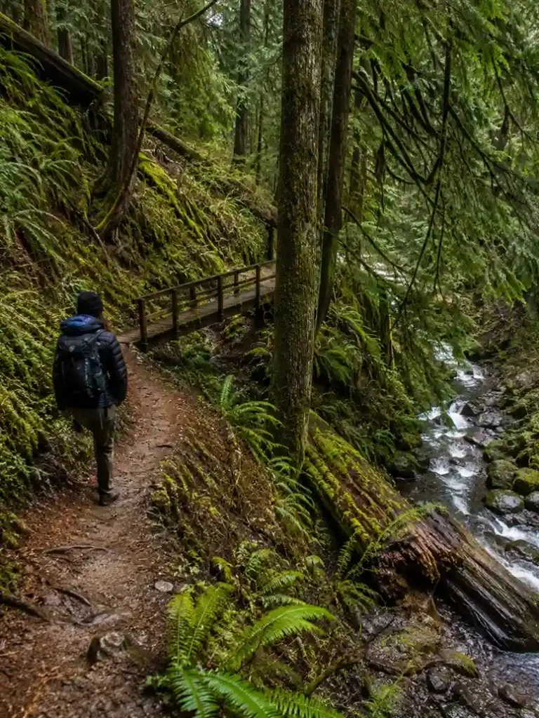
Officially marked Hart’s Cove trail #1303, the route opens in dense woods thick with Sitka Spruce and Western Hemlock — expect it dim and often foggy through that first half-mile as the switchbacks drop you down a steep forested hillside. The narrow trail hugs some real steep drop-offs here, so watch your footing; honestly, I wouldn’t bring young children along this particular stretch. You’ll hit Cliff Creek and cross a bridge into what feels like older forest, where the walking turns less strenuous and sea lions barking starts drifting up from somewhere below. Around 1.5 miles in, a wooden bench overlooks the cove, giving you your first real glimpse of Pacific Ocean water through the branches.
The final stretch thins into sparse forest, and on the last mile you might need to climb over a fallen log or two — most are scramble-friendly since they’ve already been sawed through, leaving a doorway cut between massive tree trunks, some 5 feet across. About ¾ mile from the overlook comes a stream crossing; when I went, it was a washed out bridge situation, just a narrow creek and shallow creek you can hop without soaking your boots. From there it’s roughly 20 minutes to the meadow. That whole significant descent through rainforest crosses several seasonal creeks, from the sturdy bridge at Cliff Creek to a trickier bridgeless crossing at Chitwood Creek, with sections that turn rocky, rooty, and slippery right before the steep grassy meadow opens onto the ocean’s edge.
Don’t let the wear and overgrowth put you off — it genuinely adds to the adventure. Watch for a hole in bridge planking that drops a few feet, and if you’re hiking in June, keep an eye out for Salmon berries along the path, plus a few lucky elk sightings in the second growth forest. I’ve also noticed thick patches of skunk cabbage lining the old road on the Cascade Head crossing. Between the three trailheads feeding into the meadow viewpoints — the Nature Conservancy trailhead and the two Forest Service trailheads, both under a January to mid-July closure — you’ll pass through second-growth Douglas fir, spruce, and alder for about one mile before the trees open up. That’s usually when white yarrow, goldenrod, pink foxglove, and Indian paintbrush start showing off along the edges.
Views — Chitwood Falls & Hart’s Cove
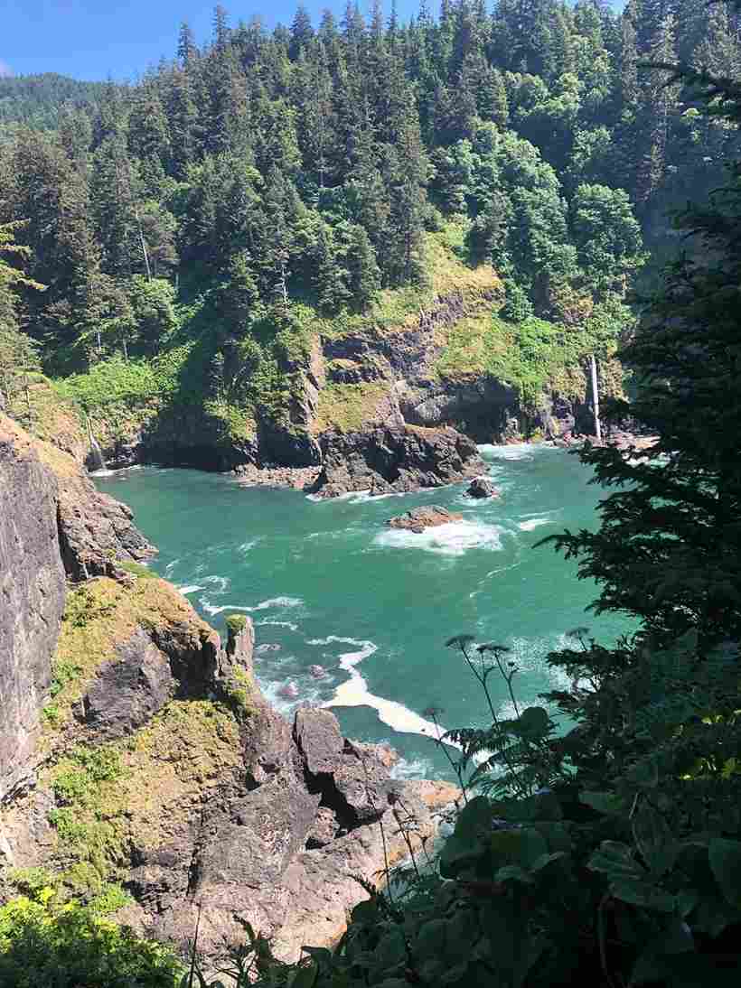
When the trees finally give way, the expansive Pacific Ocean hits you in vibrant blues you don’t quite expect this far north. You’re standing in a meadow of native grasses perched above sheer cliffs, part of the broader Cascade Head system that protects rare plants and rare animals, plus fields of wildflowers that shift with the season. The path down toward the cliff has a genuinely slippery section, so take it slow. From here, spurs branch east and west toward different vantage points, each with its own gorgeous view.
Below you, waves crash onto rocks in that unmistakable turquoise color the Oregon Coast is known for. Look into the U of the cove and you’ll spot Chitwood Falls, which plunges into Pacific Ocean water from a fair distance — pack binoculars if you want a closer look. A quick safety note: there are no fences on this headland, and it’s genuinely easy to slip near the cliff edge, so know your limits before getting close. Once you’ve had your fill, the return to trailhead means tackling those steep uphill switchbacks again — save some energy for it.
From the cliff-edge viewpoint, the scenic meadow stretches out before you descend the bluff toward Chitwood Creek’s waterfall, with sea lions heard not seen somewhere in the rocks below. The surrounding old-growth forest, full of towering Sitka spruce and western hemlock, gives way to a thick understory of ferns and moss on the approach. Honestly, the incredible vistas here — emerald green waters, a dramatic waterfall cascading into ocean, rocks below dotted with wildlife, and summer wildflowers framing it all — are exactly why people keep coming back.
Wildlife
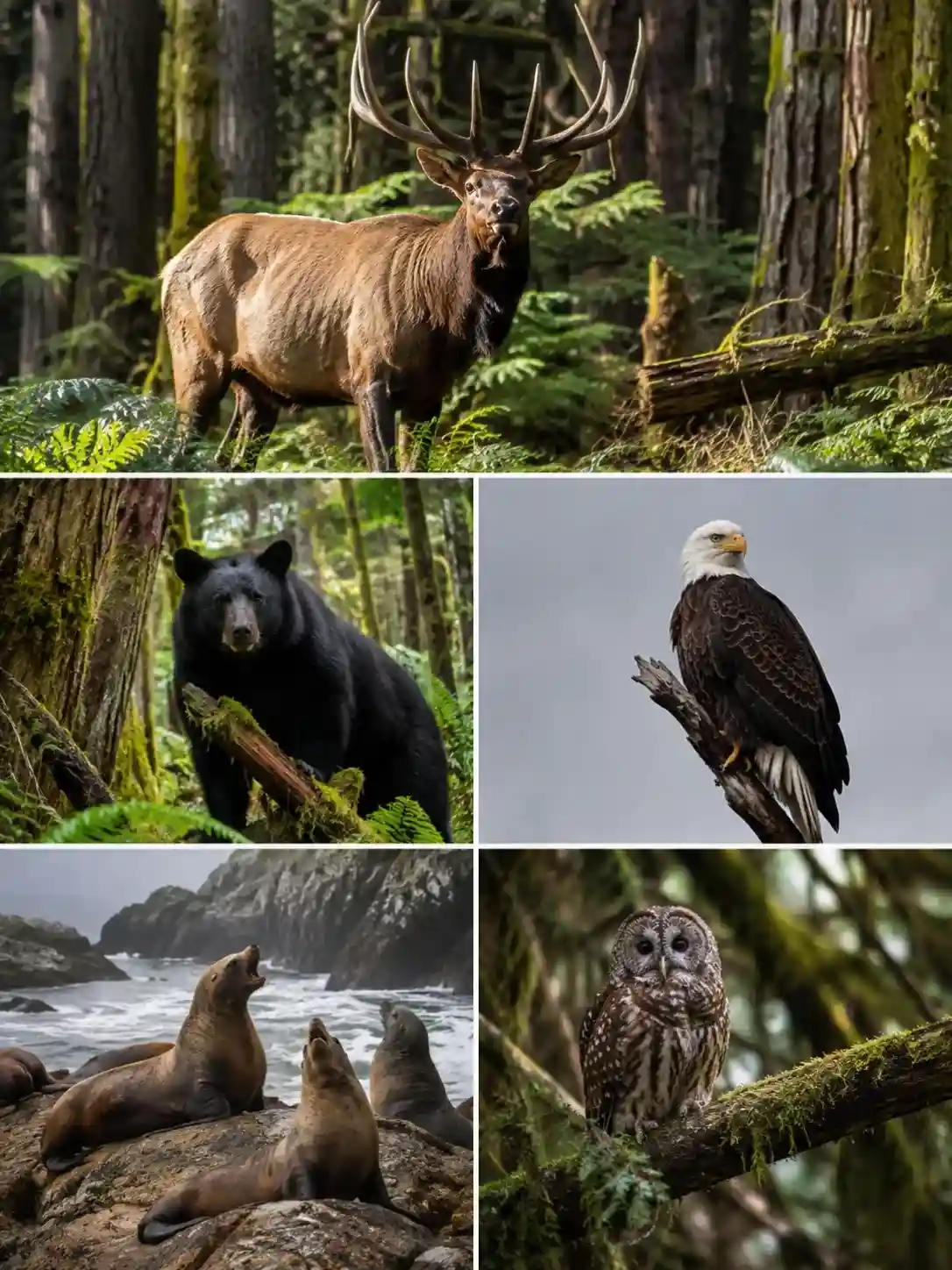
This whole protected area is serious wildlife habitat — the kind of place where you might genuinely see elk, black bear, and bald eagles in the same afternoon, along with sea lions hauled out near the cove. It’s also a stronghold for endangered species: the spotted owl, marbled murrelet, Oregon silverspot butterfly, and Coho salmon all depend on it. That’s really the point of the Cascade Head Scenic Research Area and its UNESCO Biosphere Reserve status — protecting vital habitat for creatures most visitors never even notice, like mouse, mole, and ground squirrels scurrying through the undergrowth.
Overhead, the birds put on their own show — wrens, ravens, thrushes, jays, and warblers calling from the canopy the entire way down. As for the cove’s signature sound, some hikers get lucky and end up with heard sea lions barking clearly from the bluff, while others, like me on a foggy November trip, walk away having didn’t see sea lions at all despite hearing them loud and clear.
When to Hike / Seasonal Closures
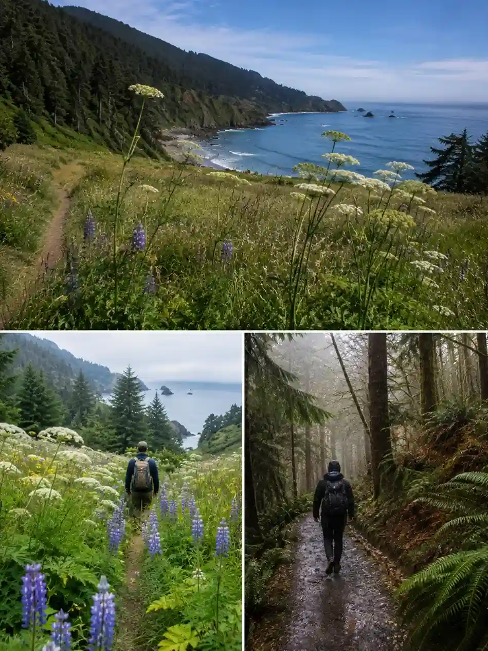
The trail is closed January 1 through July 15 every single year, protecting important habitat and keeping it undisturbed for nearly 6 months. That closure window shapes everything about planning this hike. In summer, expect the meadow full of wildflowers — lupine, cow parsnip, and yarrow among them — with prairie grasses growing uninterrupted through July and August, since no boots have trampled them since winter. Just know you’ll be pushing through tall dense grasses, so long pants or leggings are worth packing even on a hot day.
By fall, the evergreen forest of spruce, hemlock, and ferns doesn’t give you dramatic fall colors, but autumn still brings some of the clear warm days of the year, plus lighter traffic and the occasional sight of fishing boats working the cove. Winter is a different story entirely — heavy rain turns everything into a slippery trail, though it’s genuinely less trafficked if solitude is what you’re after. Just remember the sun sets 4:30 pm deep in the season, so plan your daylight carefully.
Because of the seasonal closures, the real window runs from mid-July through late fall, when you’ll typically catch favorable weather and still find wildflowers in meadow areas. This entire zone falls under the Cascade Head Scenic Research Area, protecting critical habitat for endangered species — which is also why you’ll find no dogs and no drones allowed anywhere in the preserve. The Nature Conservancy Trail portion stays open all year, but the rest of the Forest Service land only opens July 16 through December 31.
Getting There / Directions / Parking
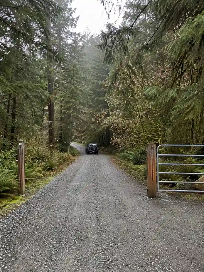
Finding the trailhead is honestly half the adventure. From Highway 101, you’re hunting for Forest Service Road 1861, an unmarked road tucked between mileposts 101 and 102 — look for a wide gravel area and a metal gate, or a gravel shoulder about a ¼ mile further up if you miss the turn. Once you’re on the gravel road, it’s about four miles of driving, with a few potholes and some washboarding to bump over. The road splits partway up, so keep left, and give yourself 10-15 minutes before reaching the parking lot at the Hart’s Cove Trailhead, roughly 11 miles north of Lincoln City and 5 miles south of Neskowin.
For directions, most people head north from the Highway 18 junction, whether you drive north from Lincoln City or drive south from Neskowin. Follow the forest road until it dead-ends — park here, and remember to drive carefully, since it’s a genuinely narrow road where you’ll need to pass other cars with care. The gate stays open July 16 – December 31; outside that window, it’s gate closed and locked to protect sensitive habitat and threatened species.
These days, a landslide has complicated the classic approach, so a lot of hikers now start on the Rainforest Trail #1310 from Knight County Park instead, working up to the upper viewpoint at 1300 ft before continuing on a dirt road. Add roughly one mile walk if you’re starting from Knight Park this way. It’s become a popular alternative route — I’ve personally climbed Cascade Head and dropped over to Hart’s Cove using this exact combination, and it beats fighting for a spot in the old gravel lot.
Must-Know Details / Tips
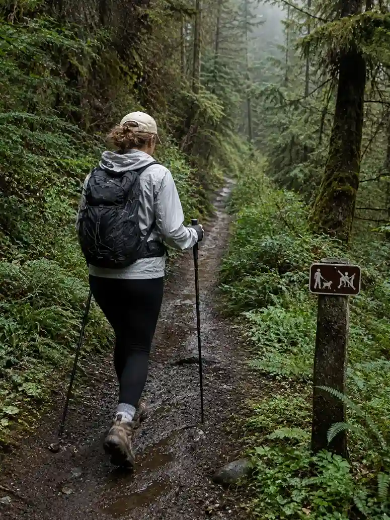
A few practical things before you go: the trail stays closed January 1 through July 15 to protect sensitive species like rare butterflies, brown pelicans, and bald eagles. Dogs allowed on-leash is the general rule, but there’s no beach access at the end, so don’t plan on tide-pooling. Expect a muddy trail most of the year, so wear sturdy shoes and bring hiking poles if you have them — they make a real difference on the descent. Dress in layers too; this stretch of the Pacific Northwest can swing from cold fog to full sun within an hour.
It’s a genuinely narrow trail in places, and there’s no restroom at the trailhead, plus expect no cell service and no data service the whole way. Since this falls under a protected area, always check local regulations for the Siuslaw National Forest before you head out. The good news is there are no permits and no entrance fee required — just double-check the USDA Forest Service website for any updated regulations.
Don’t count on the seasonal creeks either; they’re not potable water, so carry water for the whole hike, especially given the strenuous return ascent waiting at the end. I’d also suggest you bring layers, pack bug spray, and start early to beat both crowds and afternoon fog. Watch for steep climbs, a few muddy spots, and the occasional overgrown sections along the way — nothing that should stop you, just things worth expecting.