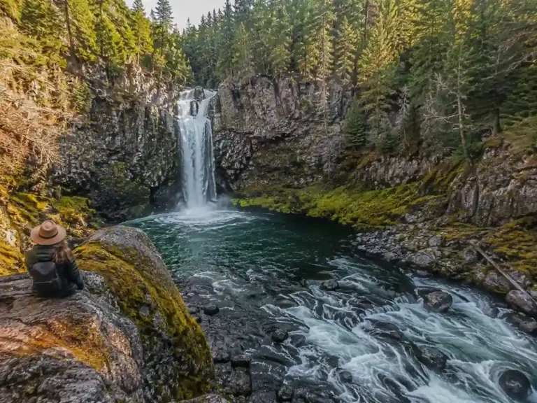
Driving the Oregon Coast: Ultimate Highway 101 Road Trip Itinerary (2026 Guide)
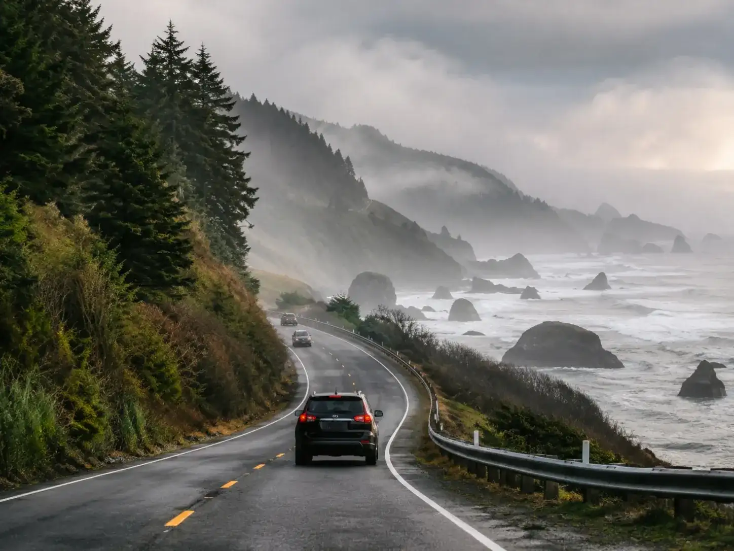
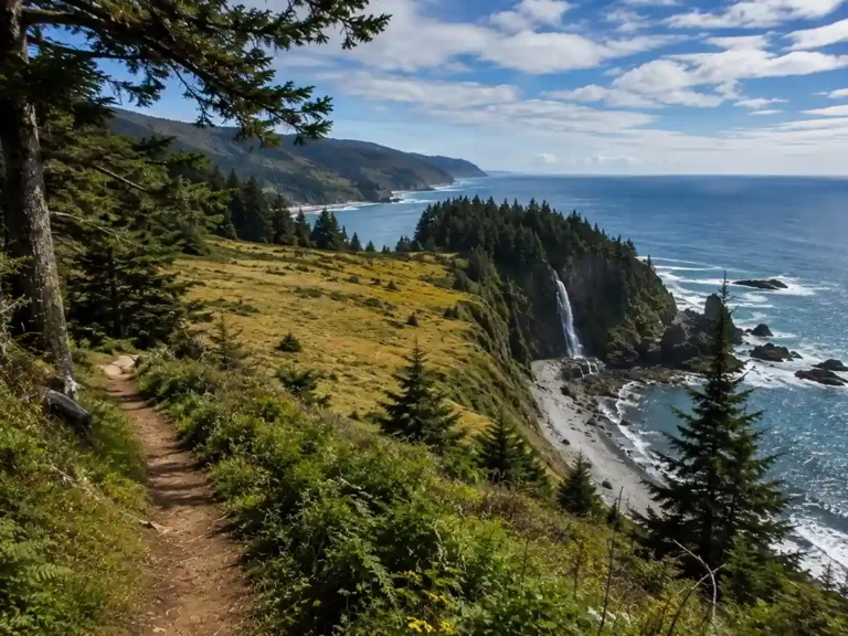
I’ve spent enough time behind the wheel along the California coast to know what makes a coastal drive worth remembering, and the first time I pointed the car north instead of south, I wasn’t prepared for how different the Oregon coast would feel. Everyone talks about Big Sur and California’s PCH like they’re the only game in town, but there’s a special stretch of U.S. Highway 101 that runs just as wild, just as accessible, and somehow still untouched in a way that surprised me as a photographer. Where California’s cliffs feel curated for postcards, Oregon’s rugged, steep rock cliffs and sea stacks feel like they don’t care whether anyone’s watching — the impressive rock formations just sit there under gray skies, doing their thing regardless of who’s looking.
The starting point for most people is Portland Oregon, close enough to the Portland airport that you can be checking into a motel by dinner. From there it’s roughly 362 miles — some maps will tell you 364 miles, depending on which detours you take — down toward a stretch of coastline as empty as Texas backroads near the California border. I’ve done it as a one day drive for people in a hurry, and I’ve also stretched those same 362 and 364 miles into a full week when curiosity got the better of me at every stopping point. Either way, this is a genuine road trip, not a highway commute: a two-lane highway hugging the water, with traffic thinning out fast once you clear the suburbs.
Spring brings migrating whales close to shore. Summer is the classic sun-and-surfing season, though the fierce wind off the Pacific means swimming is more of an idea than a plan for most visitors — the cold water here isn’t the California coast kind of cold. Fall is my personal favorite for a girls trip or a family vacay, with sunset light turning the wave-battered beaches gold as the crowds finally thin out. Winter is moodier — expect road closures, occasional snow in the higher stretches, and park closures at some of the smaller day-use areas, so pack real rain gear and don’t rush it.
What sold me on this drive wasn’t any single stop, it was the rhythm of it: slowing down past lonely lighthouses and quiet villages, sandy beaches giving way without warning to tide pools and sea life, then old-growth forests and majestic forests closing in overhead before the trees open back up onto public beaches and more lighthouses. If you need to condense trip length, you can, but this is a route built for an unhurried pace — a romantic getaway for some, a rugged splendors pilgrimage for others, and for me, mostly an excuse to catch the sunrise and sunset from as many 101 pull-outs as I could find, camera in hand, chasing the present moment through small towns the whole way down. Every write-up of the Pacific Northwest promises striking scenery, and for once the hype undersells it — every mile of the drive earns itself, the surf is colder and rowdier than it looks, and those cliffs aren’t just scenery, they’re the whole reason you came.
Astoria
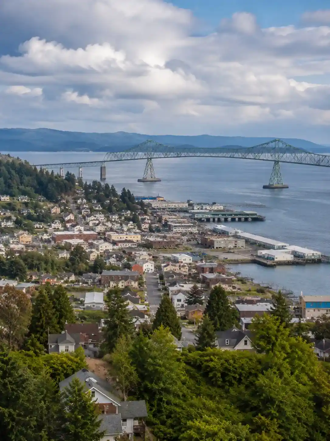
Astoria is where I always start, and it earns that spot honestly. It’s about a 2-hour drive from Portland, close enough that you could technically treat it as a day trip, but the lived-in atmosphere here made me want to slow down immediately. This is a real working waterfront, not a tourist set piece, with hills rising up behind it and river views stretching toward the mouth of Columbia River where it finally meets the Pacific.
History sits close to the surface everywhere you look. Fort Stevens State Park guards the coastline, while the Wreck of the Peter Iredale — a rusted shipwreck half-buried in sand — is one of those memorable sights that photographs don’t quite prepare you for. That shipwreck alone justifies the stop for most people, especially near low tide. A short way inland, Fort Clatsop marks where Meriwether Lewis, William Clark, and the Corps of Discovery spent their winter headquarters back in 1805, and the Lewis and Clark National Historical Park still tells that 1805 story without turning it into a theme park. Downtown, the Astoria Column rewards the climb with some of the best rooftop views in town, and a stroll past the Victorian homes on the hillside is worth the extra 5 miles on foot.
For food, I always end up at Bowpicker Fish & Chips, which is exactly what it sounds like — genuine fish and chips served out of a converted boat parked in a gravel lot, somehow among the best seafood on the whole trip. Along the Riverwalk, another string of historic waterfront buildings has been turned into shops and cafés, all within 5 minutes of the Columbia River.
Where you sleep here matters more than usual. The Cannery Pier Hotel & Spa sits right over the water for the classic waterfront stay, the Hotel Elliott leans into a more boutique vibe inside a beautifully kept historic building, and the Norblad Hotel is the budget-friendly option if you’d rather spend the savings on dinner. Any of the 2 would work as your first night’s rest before the coast really begins.
Cannon Beach & Ecola State Park
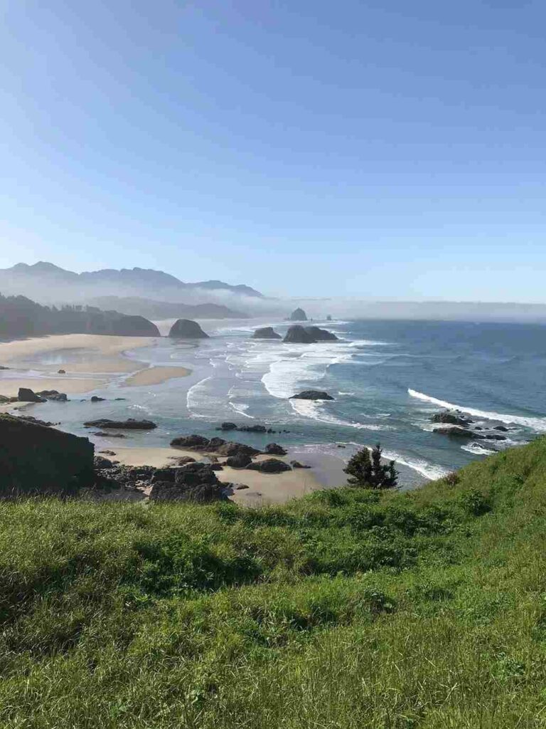
Cannon Beach is iconic for a reason, and also, I’ll admit, crowded for a reason. Haystack Rock is the imposing rock structure everyone comes for, rising out of a flat sandy beach that’s become a genuine photographer’s dream, especially at low tide when the sea caves and tide pools around it fill with sea creatures and other marine life. It’s one of the top beaches in the United States, and the surf-pounded beach setting makes it obvious why surfers show up here every summer months in force.
Just north, Ecola State Park offers some of the best panoramic ocean views on the whole route, though a past landslide left some trails damaged, so check conditions before committing to the full loop. The Indian Beach Trail and Cape Falcon Trail both branch off from here, and between the two there’s enough coastal hiking and forested hiking trails to fill an entire day of hiking options — I’d budget real time for Indian Beach itself, since it’s easy to lose an afternoon there. Entry runs a modest $5 day pass, part of the State of Oregon park system, and it’s roughly 22 miles, sometimes listed as 22, south of Astoria.
For an overnight stay, the Stephanie Inn and Surfsand Resort both deliver genuine oceanfront stay comfort with gorgeous architecture and laid-back luxury baked into the design, while Ecola Creek Lodge works well as a family-friendly beachfront resort for anyone traveling with kids. Seaside hotels nearby fill in the gaps if those book out.
When it’s time to eat, Driftwood Restaurant and the wider spread of restaurants around town lean hard into coastal comfort food — think clam chowder thick enough to stand a spoon in. And if you have an extra hour, ask locally about the hidden waterfall tucked past Hug Point on the way south; it’s the kind of stop most drivers blow right past.
Hug Point
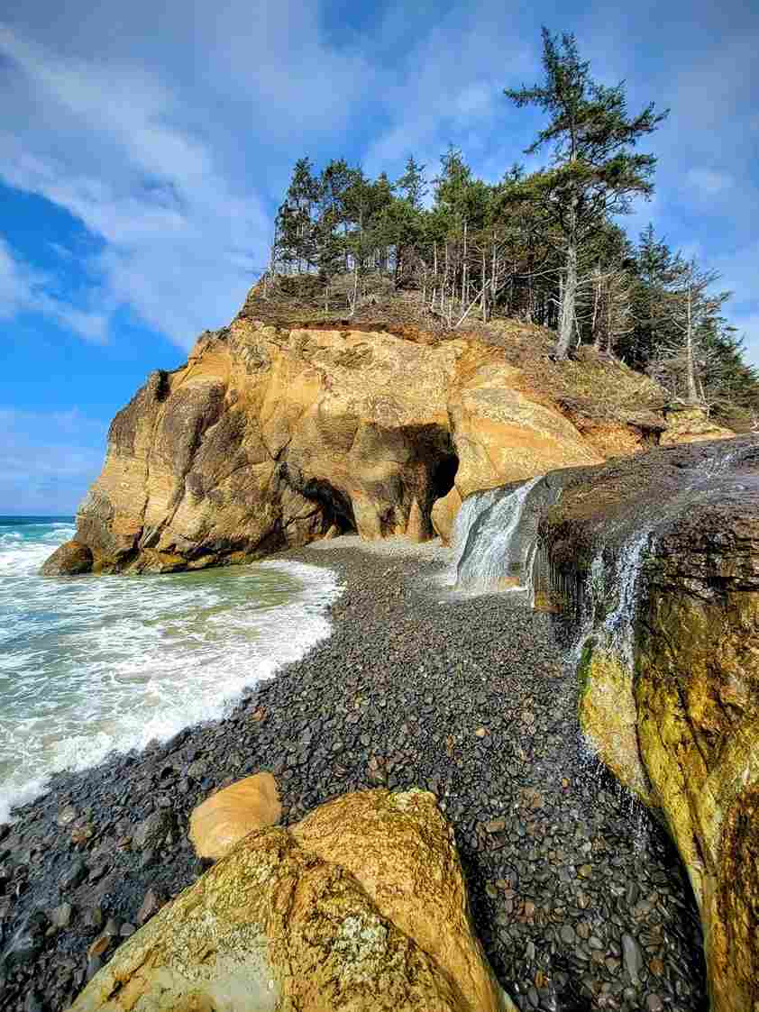
Hug Point rewards patience more than almost anywhere else on this stretch. Time your visit around low tide, since much of what makes this spot special — the tide pools, the sea caves, and a genuinely hidden waterfall spilling straight onto the sandy beach — disappears completely at high water. It’s a short, leisurely walk from the parking area, past a weathered rock cliff and unusual rock formations that feel almost sculpted. Check a tide chart before you go; this is a small stop, but it’s earned its spot beside Haystack Rock as one of the coast’s quieter natural features.
Tillamook Creamery & Three Capes Scenic Loop
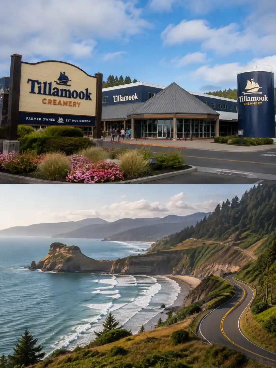
Tillamook is dairy country, plain and simple, and the Tillamook Creamery is the reason most people stop. Between the cheese tastings, the ice cream, and the general self-guided tour of how Tillamook ice cream and yogurt actually get made, it’s an easy hour, and honestly a good excuse to stock up like a grocery store run before heading into quieter stretches with fewer options. Grab lunch here, or wait for Pacific City, home to the region’s best artisan café.
From Tillamook, the Three Capes Scenic Loop peels off Highway 101 for a 35-mile circuit — sometimes rounded to 35, sometimes stretched to 40 miles or simply 40 depending on your exact route — through some of the most underrated Pacific scenery on the whole trip. Cape Kiwanda delivers a dramatic sandstone headland and views over to Oceanside, while Cape Lookout State Park offers a proper hike through lush green fields and forest down to the water, with sweeping viewpoints the whole way. Watch for whales offshore in season. If you’re staying over, an Airbnb in the dairy region beats a chain motel every time, though reservations fill up fast in summer — try booking through something like Bluebell cottages if the bigger names are sold out.
Oswald West State Park
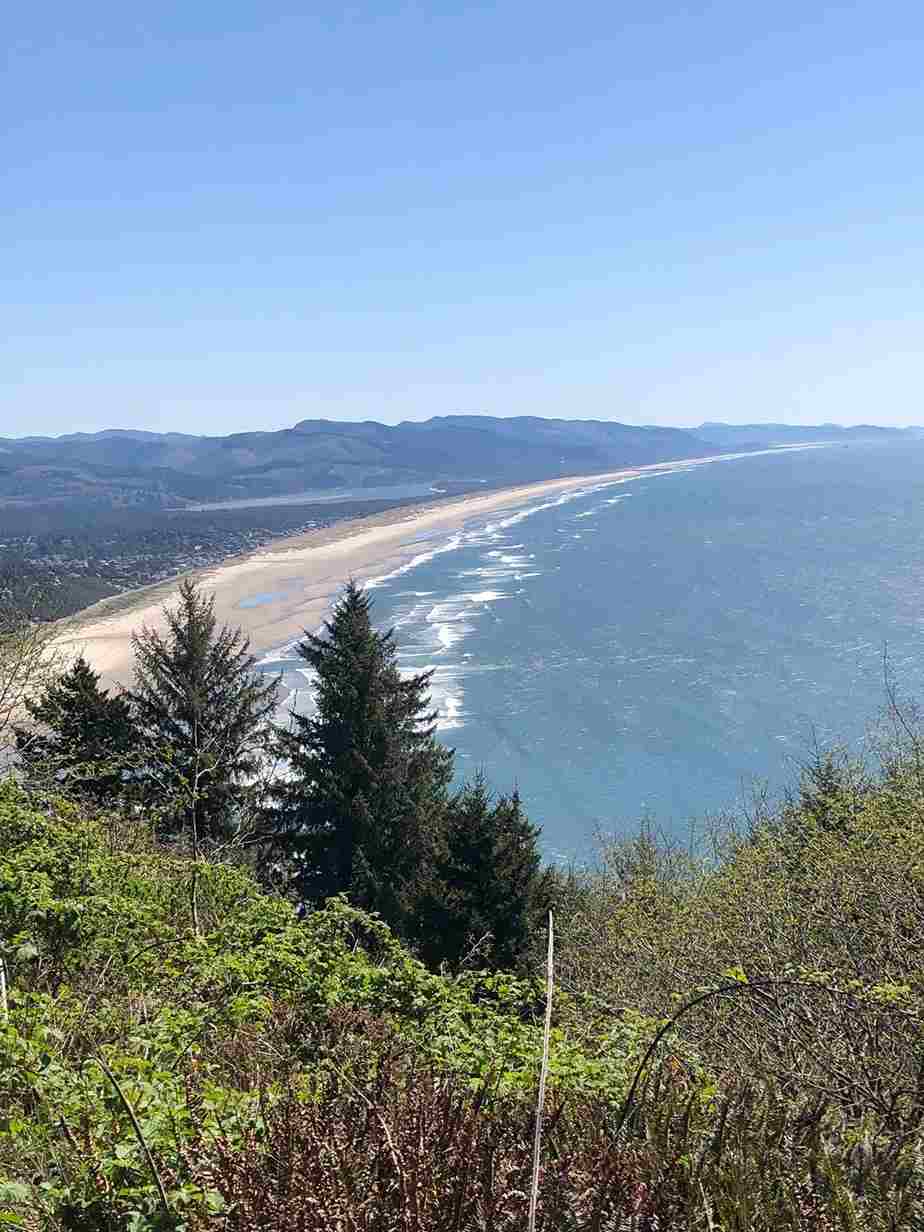
Oswald West State Park doesn’t announce itself from the highway, which is exactly what makes it a hidden gem. A short walk through old-growth Sitka spruce brings you out to Short Sands Beach, a genuinely sheltered surf cove protected from the worst of the wind, and one of my favorite coastal spot finds on the entire drive — check AllTrails before you go, since the unmarked turnoff is easy to miss. The Cape Falcon Trail starts here too, threading along dramatic cliffs with ocean views the whole way.
Sleep options nearby lean rustic in the best sense: Sheltered Nook offers genuinely charming coastal cottages built as a self-contained retreat, the Garibaldi House Inn adds a complimentary breakfast into the mix, and Tillamook Bay City RV Park covers anyone road-tripping with a trailer in tow.
Depoe Bay (Whale Watching) & Lincoln City
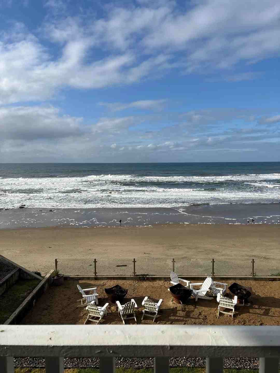
Depoe Bay calls itself the nation’s smallest harbor, and it backs that up with an outsized reputation as the northern coast’s whale-watching boats hub — genuinely the northern coast’s main hub for spotting gray whales during their annual migration, whether that’s spring, summer, or fall. The Whale Watch Center, also listed as the Whale Watching Center, sits right on the basalt landform overlooking the open sea, and it’s free to walk in. Watch for sea lions hauled out below, sometimes an entire rookery of them.
Beyond whales, this stretch is known for glass float hunting — keep an eye out along the shoreline for hand-blown floats that wash in from artists who seed the beaches on purpose. God’s Thumb, a striking 20-ton volcanic feature, sits about 12 miles, or 12, south near Lincoln City, with forested bluffs and beach views worth the detour.
For accommodation, the Inn at Wecoma and D Sands Motel both deliver solid beach views, while Salishan Coastal Lodge ups the comfort with an on-site heated pool if you want a night off from hiking boots.
Newport & Yaquina Head Lighthouse
Newport is a genuine resort town with a working Bayfront still home to real commercial fishing fleets, and it earns its reputation as the northern coast’s main hub for seafood — order the Dungeness crab or a bowl of clam chowder and you won’t be disappointed. Nye Beach offers a quieter stretch of sand right in town, and the Yaquina Bay Bridge, designed by Conde McCullough, remains one of the most photographed spans on the coast; it dates to 1930s construction, sometimes cited simply as 1930.
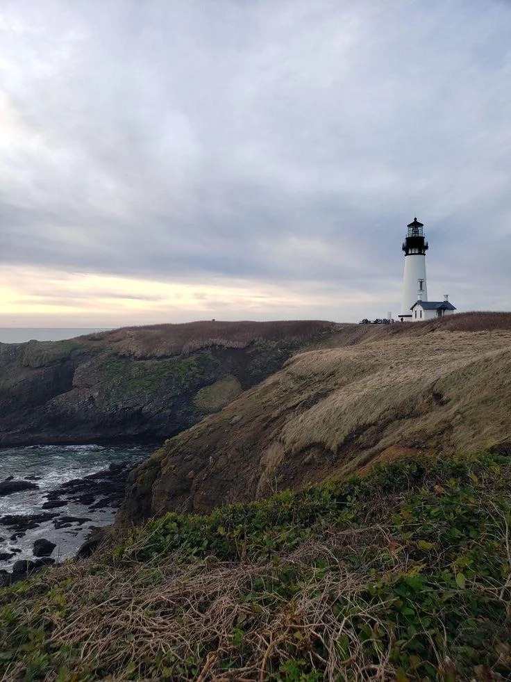
Just north, the Yaquina Head Outstanding Natural Area, managed by the Bureau of Land Management, centers on the Yaquina Head Lighthouse, a working lighthouse perched on a basalt headland since 1873 — a date worth remembering, because it comes up twice in most histories of the site, and by 1873 it was already guiding ships past these offshore rocks. The staircase up to the original light fixture is open to visitors most days, and admission runs through a modest entrance fee, or free entry if you’re carrying a National Park Inter-agency Pass. Down below, tide pools hide sea otters, harbor seals, and nesting tufted puffins and other seabirds along the cliffs — bring binoculars.
The Oregon Coast Aquarium rounds things out with proper sea otter exhibits, sea lion exhibits, indoor tanks, and an outdoor aviary, making it one of the better wildlife sanctuaries for a foggy morning when the beach isn’t cooperating. Fog, honestly, is part of the deal here — plan for it, and aim for mid-morning if you want the best odds of it lifting. It’s about 13 miles, or 13, north of Depoe Bay.
Where to stay: Elizabeth Oceanfront Suites and Hallmark Resort both offer fireplaces and hot tubs with real ocean frontage, Travelodge Newport covers the budget end, and the historic Yaquina Bay State Recreation Site includes an old two-story wooden house worth a quick look even if you’re not staying nearby.
Yachats, Cape Perpetua & Thor’s Well
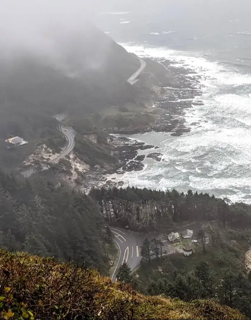
Yachats is the kind of charming town you plan to pass through and end up staying in longer than intended. It sits right at the base of Cape Perpetua, an 800-foot headland — sometimes rounded to 800 — that’s easily reached by car, with the Cape Perpetua Overlook delivering the highest viewpoint on the whole trip if you’re short on time for the full hike.
Down at the water, Thor’s Well is the reason most people detour here at all: a collapsed sea cave that pulls seawater down through a blowhole-like opening in a dramatic natural concentration of force, throwing up an unexpected wave every few seconds. Time it around high tide for the full effect, but stay well back — this stretch has claimed careless visitors before, and the sharp rocks around it are no joke. Wear real footwear, not sandals. Nearby, Devil’s Churn offers a similar, slightly calmer show of geysers and churn during storms.
This whole area is car-accessible, which is rare for terrain this dramatic, and it’s managed largely by the U.S. Forest Service — expect an annual pass requirement or free parking only in the off-season. Beach walks here turn up agates, and low tide brings out starfish, clams, and crabs among the rocky coves. It’s 24 miles, or 24, of genuinely varied old-growth forests and coastline.
For food, the Green Salmon Coffee Company is where I start every morning here, and Luna Sea Fish House covers dinner with some of the top-tier restaurants seafood on this stretch. The Fireside Motel is the easy pick for sunset views right from your room.
Heceta Head Lighthouse & Sea Lion Caves
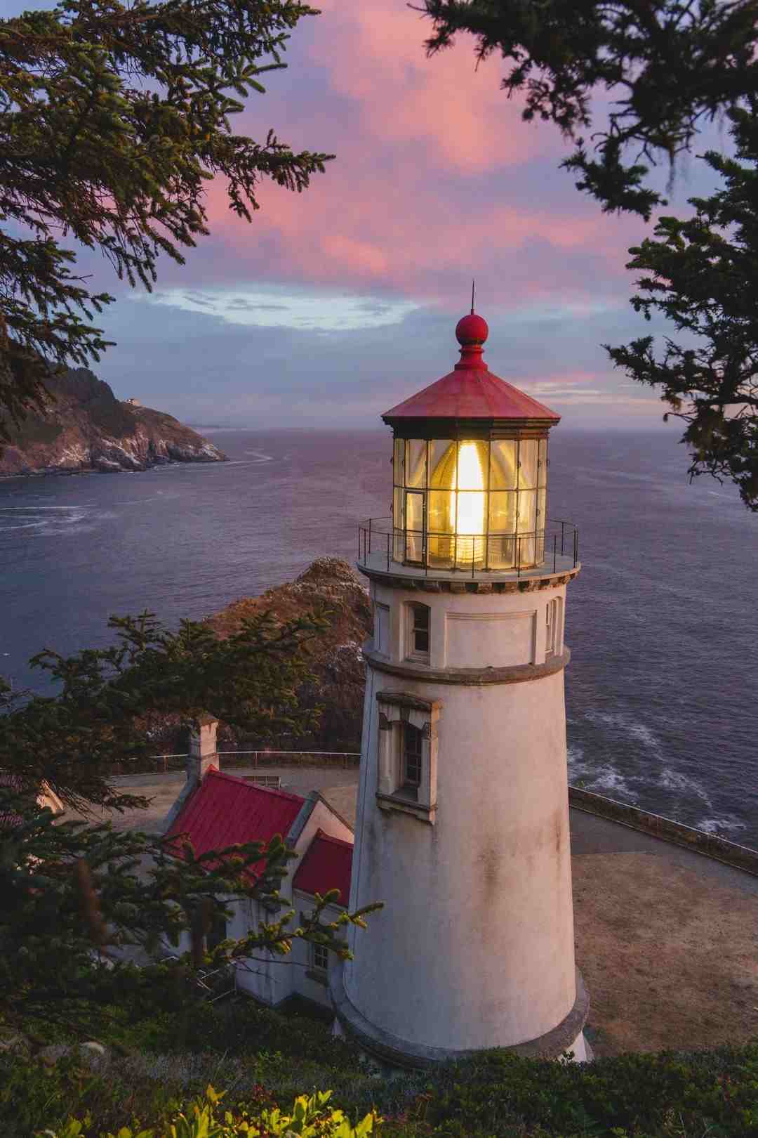
The Heceta Head Lighthouse is, by most counts, one of the most photographed lighthouses on the West Coast, or the US more broadly, and once you see it perched above a curve of sandy beach, it’s obvious why. A 1/2-mile trail, or 0.5 miles, climbs from the parking lot up to the rocky promontory where the lighthouse and its old elevator-equipped keeper’s quarters still stand, now run as the Heceta Lighthouse B&B for a genuinely historic experience.
Just south, Sea Lion Caves takes you down via elevator to a natural sea cave functioning as an active sea lion rookery, with a viewing window looking straight out at animals hauled out just feet away as crashing waves roll in. Entry runs a $5 parking fee at the pullout above.
Sleep options nearby include the Park Motel, budget and simple, or the River House Inn for a proper riverside stay with private balconies overlooking the water — the kind of picturesque lighthouse views worth paying a little extra for.
Florence & Oregon Dunes National Recreation Area
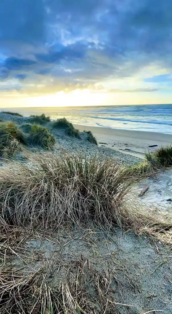
Florence sits at the edge of a genuinely strange landscape: the Oregon Dunes National Recreation Area, a 50-mile swath, sometimes described as 50, of towering coastal sand dunes running down toward Coos Bay. These aren’t small hills — some reach 500-foot sand dunes, or 500, and the whole thing feels like an unexpected landscape to find on the Oregon coast at all.
The historic old town sits along the Siuslaw River, with a proper waterside promenade lined with wooden storefronts left over from the timber boom, giving it real historical character — this was timber country long before tourism, and the California Gold Rush era briefly pulled prospectors through too. Dune hikes are worth the sand in your shoes, and sandboarding or ATV tours are the more adrenaline-driven way to see the dunes if walking isn’t appealing.
For camping, Jessie M. Honeyman State Park and its Honeyman Campground offer genuine freshwater lake swimming right next to the dunes, which felt like a strange, welcome throwback to childhood summer trips for me. It’s about 15 minutes, or 15, from the Cape Arago Highway turnoff south toward South Coast country. Stock up on provisions before you leave town — options thin out fast heading south, whether you’re bound for San Francisco eventually or just the next state park. The Driftwood Shores Resort offers the best oceanfront rooms in Florence itself, and the Landmark Inn covers the budget option downtown.
Shore Acres, Cape Arago & Bandon (Face Rock)
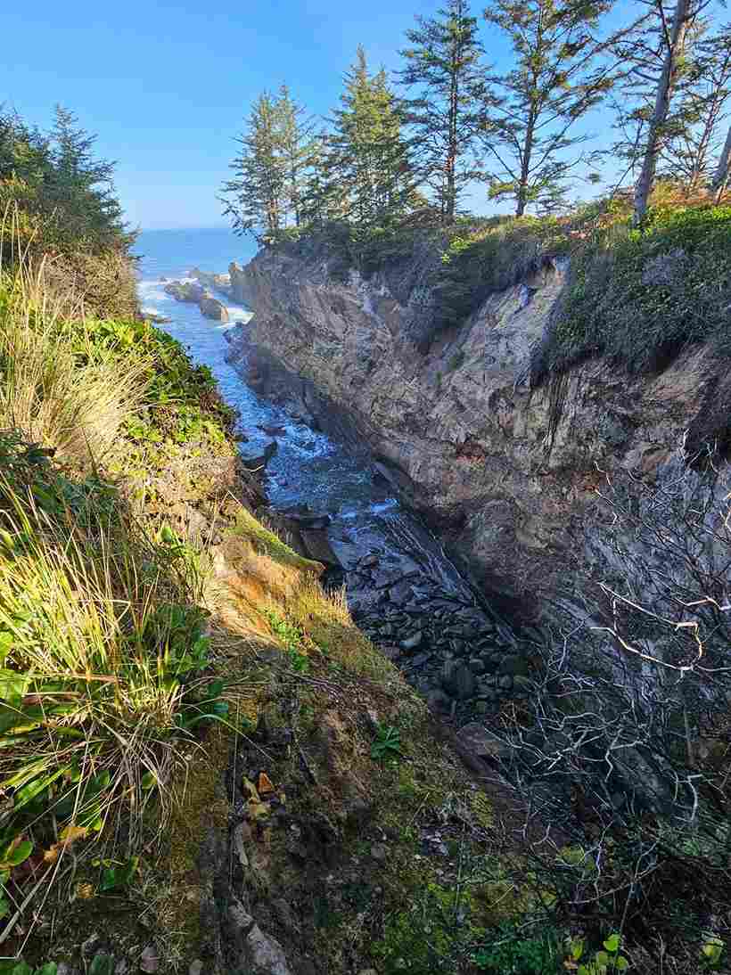
Shore Acres State Park was once a private estate, and the botanical garden and formal rose garden left behind still feel almost out of place against the wild Pacific backdrop — genuinely one of the more surprising stops on the whole route. Nearby, Cape Arago State Park and Sunset Bay State Park round out a trio of parks worth the short detour, with sheltered cove swimming and tide pooling.
Bandon is where Face Rock and the wider Beach Loop Drive take over — a proper sea stack-dense beach packed with formations locals have named individually, including Table Rock, the Sisters, and the offshore group nicknamed Cat and Kittens. The Face Rock Viewpoint is the easiest place to take it all in, especially near sunset spot hours when the light hits the monoliths just right and you can hear seals barking somewhere out on the offshore rocks.
History runs deep here too: the Coquille River Lighthouse, dating to 1896, still stands guard where the Coquille River meets the sea, a full 1896 vintage structure that’s outlasted plenty of newer buildings nearby. Bullards Beach State Park protects the surrounding sandstone cliffs and dunes, and back when passenger steamers ran this coast between here and San Francisco, or as far north as Seattle, this stretch was a genuine shipping hub — a detail most visitors miss entirely.
Golfers know Bandon for another reason: the Bandon Dunes Golf Resort, home to seven links courses, or simply links courses, has become one of the most respected golfers’ destinations in the country, all built across genuine cranberry fields turned into rolling greens. For something different, glass cabins at Tu Tu’ Tun Lodge or the more standard Bandon Inn and Sunset Oceanfront Lodging round out where to stay, with some offering private beach access onto the Oregon Islands National Wildlife Refuge.
Gold Beach & Samuel H. Boardman State Scenic Corridor
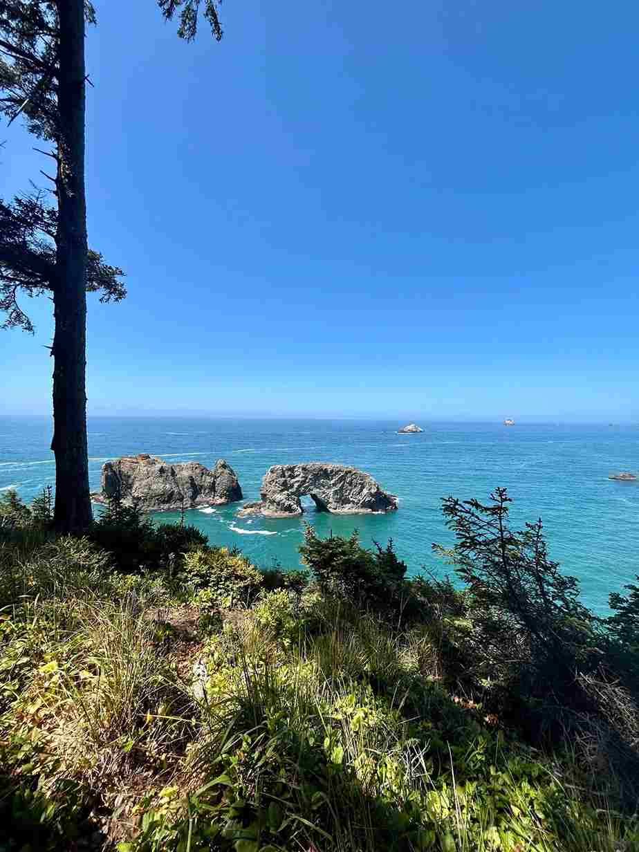
Samuel H. Boardman, or the full Samuel H. Boardman State Scenic Corridor, is a 28-mile stretch, sometimes rounded to 28, of near-continuous state parks and pullouts that I’d argue is the single best run of coastline on this entire trip. Natural Bridges, at Natural Bridges Cove, and Secret Beach are the two stops I recommend building a schedule around, both reached by short marked trails off the main coastal trail, with hiking options ranging from five minutes to a half-day depending on how deep you want to go. Whaleshead Beach adds another set of dramatic natural arches worth the stop.
This whole area sits in the Banana Belt, Oregon’s unofficial nickname for its warmest microclimate, which explains the semitropical plants and even Easter lilies grown commercially near Brookings, the last real town before the California border. Gold Beach anchors the northern end, with the Rogue River and Rogue River Trail offering a genuine jet-boat trip or multi-day hike through giant trees and remote views most drivers never see from the highway.
Where to stay: Jot’s Resort and Pacific Reef Hotel cover Gold Beach itself, while the Mermaid’s Muse Bed & Breakfast and the Frances Schrader Old Growth Trail area give Brookings its own quieter base. It’s roughly 59 miles, or 59, from Gold Beach down to the border, and about 12 miles, or 12, of that runs directly through Boardman’s best viewpoints.
When to Go
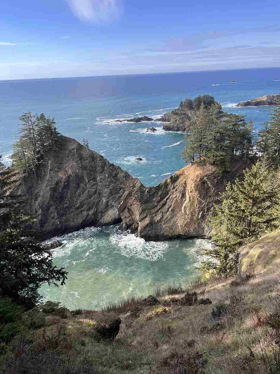
There’s no wrong anytime of year to make this trip, but July through September delivers the closest thing to ideal weather the coast offers, with the fewest foggy landscapes and the most reliable Oregon coast experience overall. Outside that window, expect moody landscapes more often than not — which, depending on your taste, might be the whole appeal of a winter run instead.
What to Know Before You Go
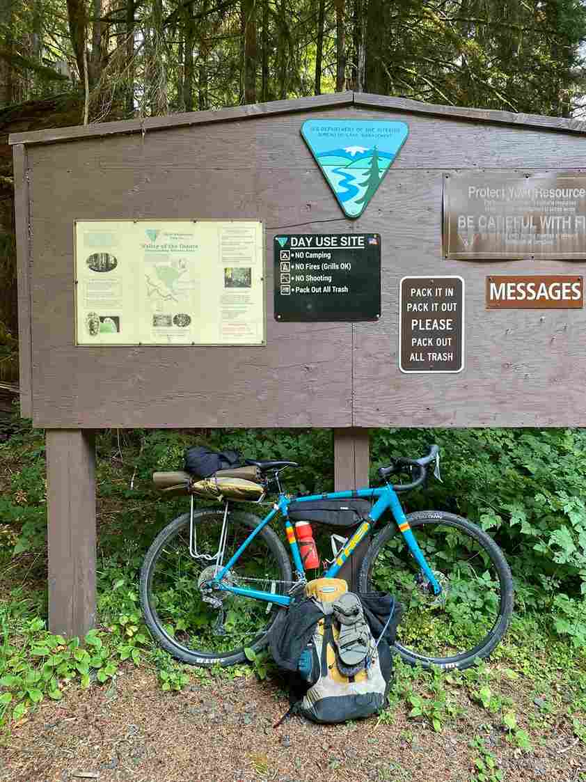
Pack like the weather will change on you mid-sentence, because it will. Real Merrell Waterproof Hiking Boots or something similar earn their keep here more than almost any other gear, since wet trails and rocky trails show up even on sunny afternoons. A proper Columbia Rain Jacket covers rainy mornings and the general damp that defines the Northwest, and sunscreen still matters despite the clouds — don’t underestimate sun strength just because it’s gray out. An Osprey Pack keeps hands free for the Nikon d3500 camera or whatever you’re shooting pictures with, and a plant-based bug spray covers the buggier forest stretches.
Most state parks run on a simple fee structure: a $5 day use fee at individual lots, or the National Park Inter-agency Annual Pass if you’re stacking multiple National Forest Service sites. The State of Oregon also sells its own pass covering entrance fees and parking fees across the system — worth it if you’re stopping often. Aim to arrive by noon where you can, since foggy mornings are common and fog clearing timelines vary wildly day to day. A refillable water bottle rounds out the list of things I never regret packing for the daily activities this trip demands.
Devil’s Punch Bowl State Park
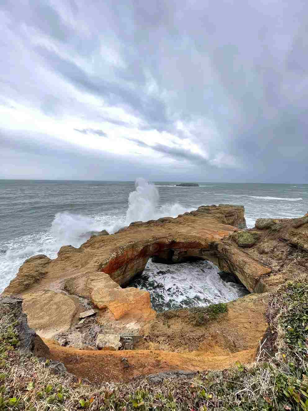
Devil’s Punch Bowl is a naturally carved bowl in the rock, and it’s easily the busiest place on this list at the wrong hour, so aim for early — 6, or even 6 am, if you want it to yourself. At high tide, waves pour into the churn through a collapsed rock headland, sending up foam and noise; at low tide, the hike down into the bowl itself becomes possible. Check the schedule of local tide tables before committing to a visit, since ocean conditions here shift fast with the tide.
Multnomah Falls
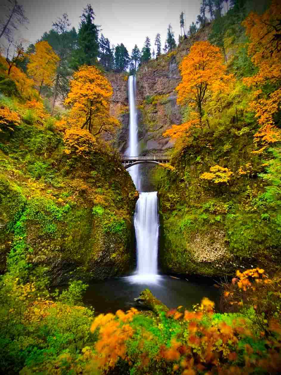
Multnomah Falls stands 620 feet, or 620, tall, making it the tallest waterfall among the more than 238 waterfalls, or 238, scattered through the Columbia Gorge. It’s genuinely one of the great Oregon waterfalls, but it comes with a catch: busy season crowds are intense enough that reservations are now required for parking at peak times, so plan ahead rather than showing up and hoping.
Rowena Crest
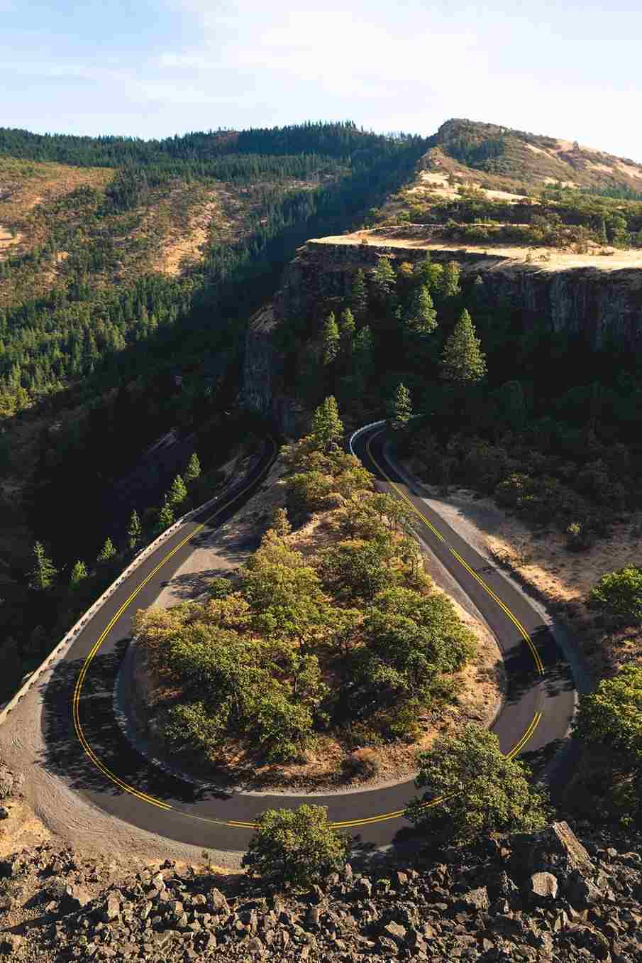
Rowena Crest delivers a genuinely unique horse-shoe road view over the Columbia River Gorge, and it’s rare among stops on this list for being a true drive-up spot — no hike required. Sunset here is worth timing carefully, though I’d skip it during heavy rain, since the view depends entirely on visibility.
Painted Hills
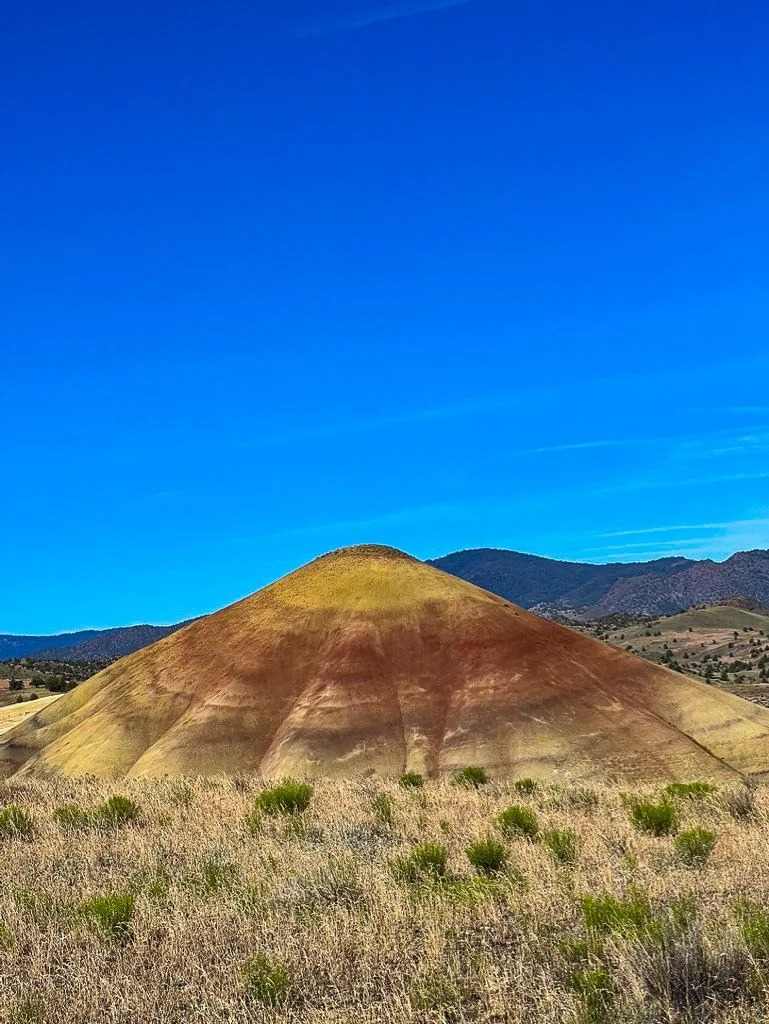
The Painted Hills are best seen at sunrise or golden hour, when the striations of colors running through the clay actually glow instead of flattening out under midday light. It’s a drive-in stop straight from the parking lot, and the Painted Cove Trail, a short 0.3-mile trail, or 0.3 miles, loops out along a raised walkway so you’re not walking directly on the fragile clay — stick to it, even if it only takes 30 seconds, or 30, longer.
Smith Rock
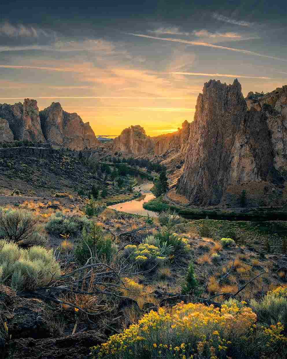
Smith Rock State Park looks like something out of a different planet — genuinely a random landform rising out of flat high desert, popular with climbers and known as a hikers haven more broadly. Locals half-joke it looks like where dinosaurs should be roaming.
Tamolitch Falls (Blue Pool)
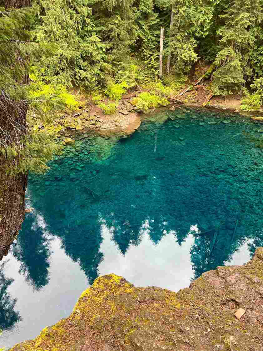
Tamolitch Falls, better known as the Blue Pool, sits at the end of a short hike through douglas fir forest built over old lava flows. The water itself is the draw — a startling blue basin fed by frigid water that stays that color no matter the season.
Sparks Lake
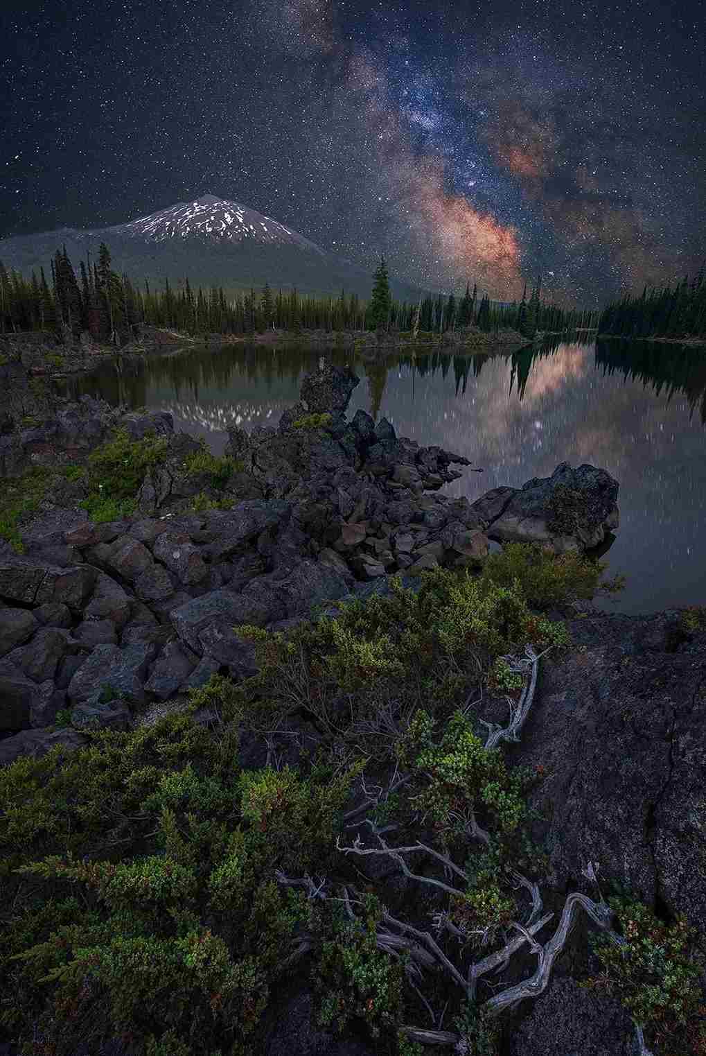
Sparks Lake, just outside Bend Oregon, is a reliable drive-up spot for sunrise photography, and one that somehow still avoids the worst of the crowds compared to more famous nearby spots.
Umpqua Hot Springs
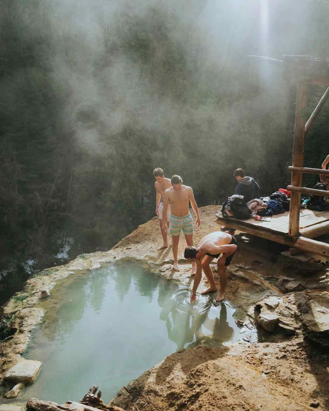
Umpqua Hot Springs is genuinely a fragile spot, so treat any hot springs trip here with real care — pack out everything you bring in. It’s also become a crowded spot on weekends, so a few honest visit tips: go early, go on a weekday, and don’t expect to have it to yourself.
Toketee Falls
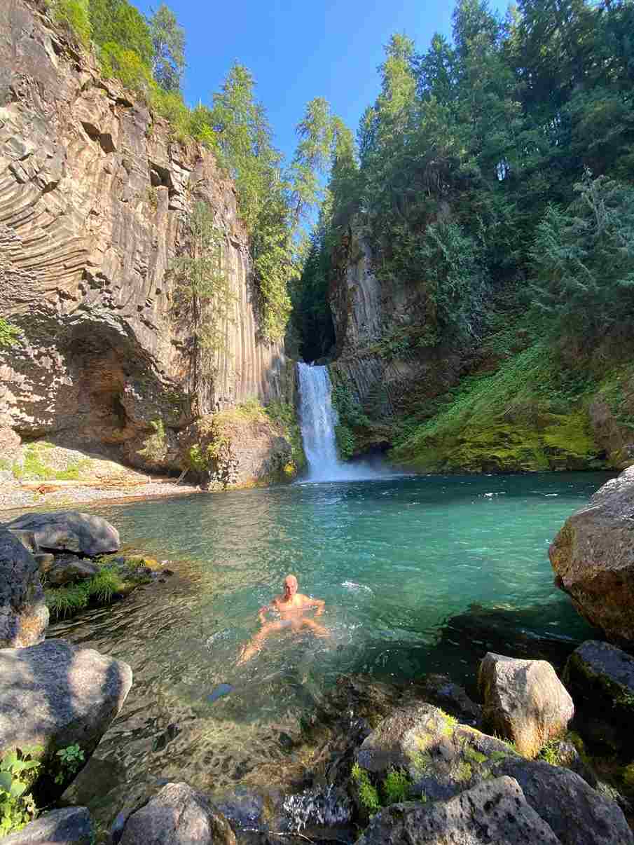
Toketee Falls is reached by a short 0.9-mile trail, or 0.9 miles round trip, ending at a waterfall spilling over stacked basalt cliffs into strikingly blue water below — one of the more underrated stops inland from the coast proper.
Crater Lake National Park
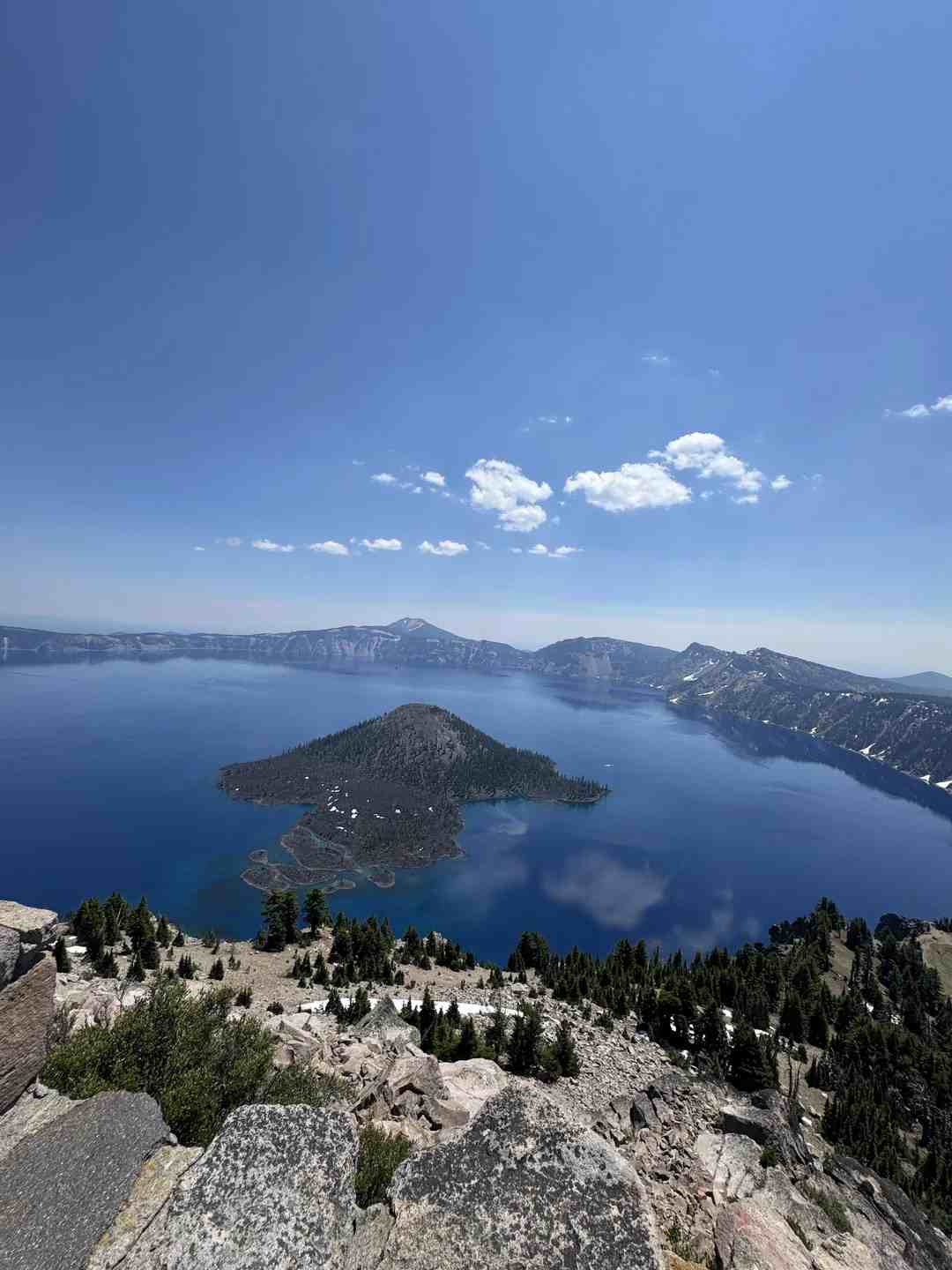
Crater Lake holds the title of the deepest lake USA has to offer, plunging to 1,943 feet, dated back to a caldera collapse from fire roughly matching the 1943 figure most guides cite. Even a brief visit here is worth the detour, and the historic Crater Lake Lodge makes a solid overnight base if you want more than a quick look.
Sharkfin Rock at Gold Beach
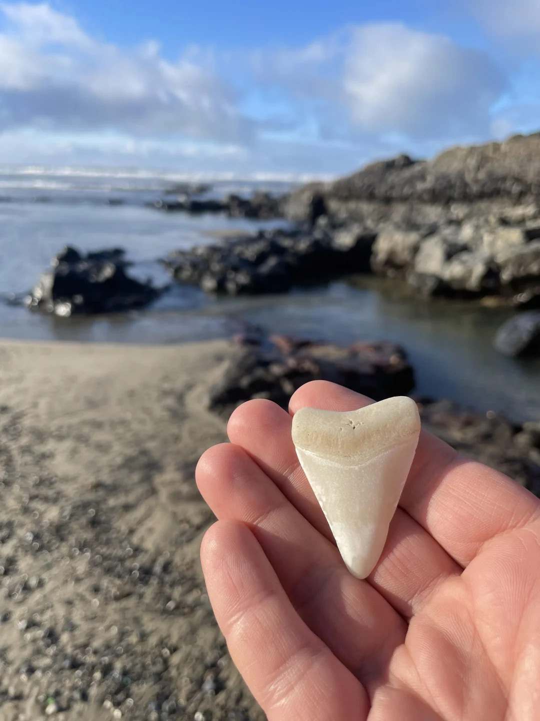
Sharkfin Rock, near Gold Beach, is one of those happy accident discoveries — an odd, fin-shaped formation among the wider rock formations along the Oregon Coast that most guidebooks skip entirely. Beach access is straightforward, and sunset is, unsurprisingly, the best time to see it.
At a Glance: Oregon Coast Road Trip
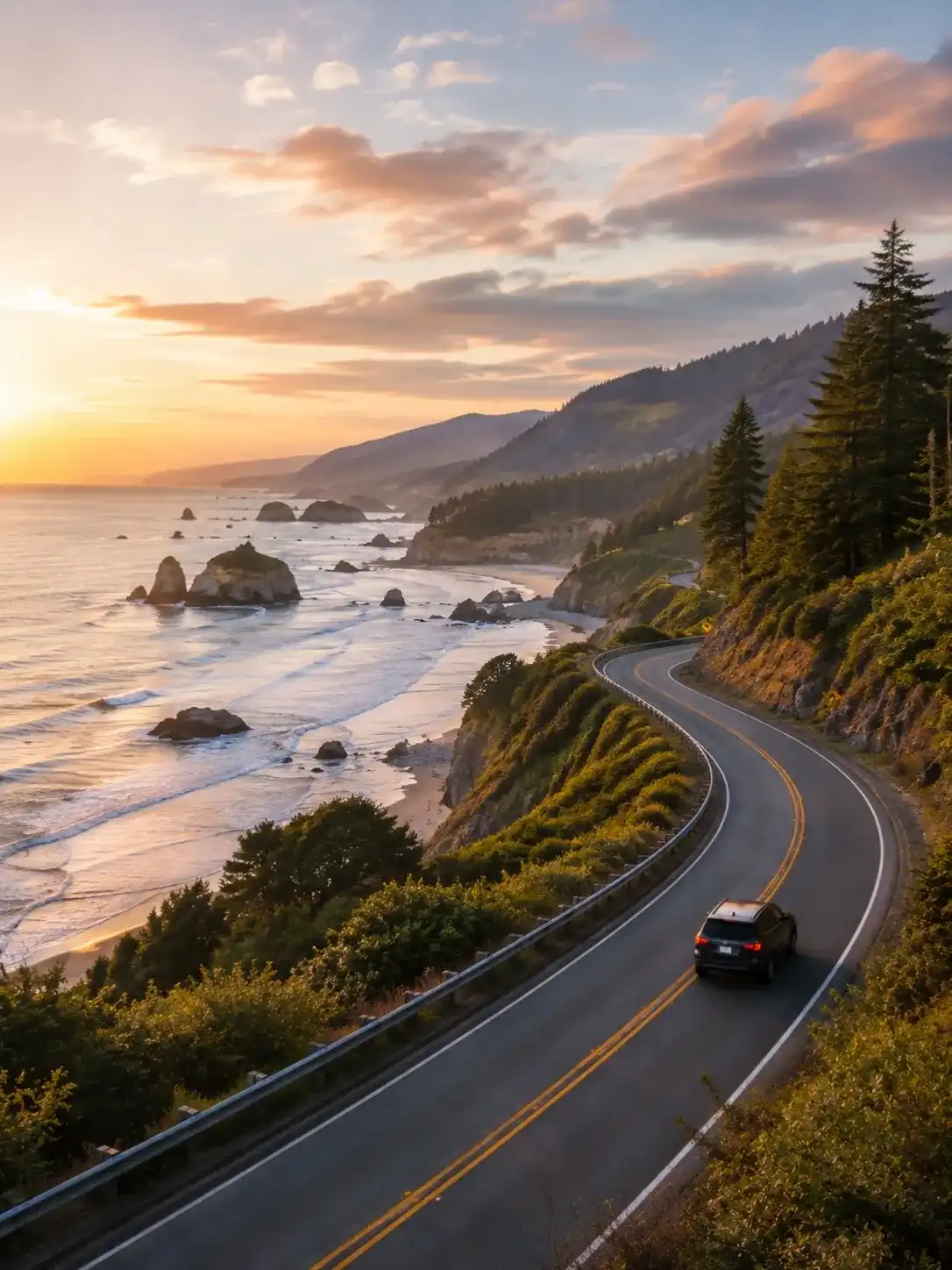
For highlights: Astoria is the classic starting point heading north to south, with Brookings near the southern coast as the natural endpoint, though plenty of drivers reverse that. Full total distance runs about 362 miles, or 362, covering the full coast. Budget drive time of roughly 7 hours, or 7-8 hours, non-stop, though almost nobody actually drives it that way. The recommended trip length runs from a rushed 3 days up to a leisurely 5-7 days, with 2 hours here and there for detours.
Best time to go leans toward July or September for warmer, sunnier conditions, and pick up an Oregon State Parks Annual Pass if you’re stopping at more than two or three park passes-required lots. Fly into Portland PDX as the easiest starting point, rent a rental car rather than relying on transit, and stick to Highway 101 the whole way for sunset views and steady pull-outs along the ocean-side lane, whichever best direction you end up choosing.
Tips for Driving the Oregon Coast
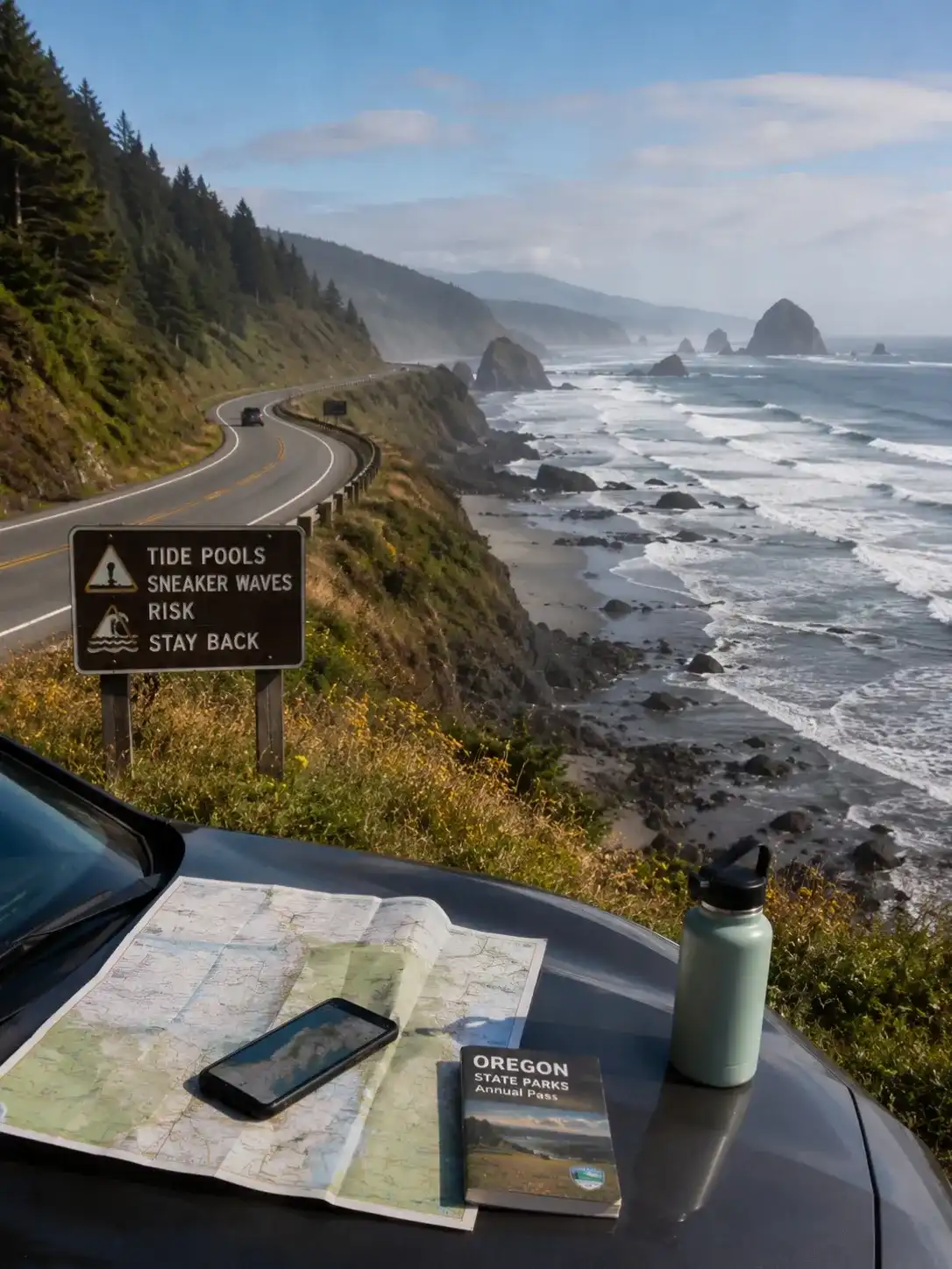
Download offline maps before you lose cell service, which happens more than you’d expect along quieter stretches. Grab a tide app too — spots like Haystack Rock and Thor’s Well genuinely depend on knowing tide times, since sneaker waves can and do reach well past the waterline without warning; treat every stretch of rocks and driftwood logs with real respect.
Fill up whenever you see gas stations, since they thin out fast on the southern coast. Budget around $30 for an Oregon State Parks Annual Pass, which covers parking and a park pass at most Ecola State Park-style lots, and try to reach popular spots by 9am, or 9, before both crowds and parking lots fill up for the day. Even at Gold Beach, the quiet stretches can turn busy fast once the fog lifts.